
From space
Furtado from space
The satellite record shows how Furtado changed before and after the 2025 fire. It is a baseline for future work, with each measure linked to its source.
-
A 14-hectare hub in the Serra da Estrela
Furtado has three parcels of steep slopes and old olive terraces on the western side of Portugal’s Serra da Estrela. It is one of Bioestrela’s hubs, close to Valezim.
14 hathe size of the hub3separate parcels of land
-
Tree cover in 2000
Trees covered 72% of the hub. The Global Forest Change record shows Furtado and nearby hills mostly under trees.
72%of the hub was under trees
Tree cover, stronger where it is denser
-
Tree loss in 2012
Satellite data shows that 12 of the hub’s 14 hectares lost tree cover in that single year.
12 haof the hub’s 14 hectares lost their trees in 2012
Tree loss in 2012Tree loss in other years since 2001
-
Forest type in 2020
The ForTy forest map classifies 84% of the hub as plantation forest and 7% as naturally regenerating woodland. The natural woodland was mostly a small strip in the south.
84%plantation forest7%natural woodland growing back
Plantation forestNatural woodland growing backOther land
-
Before and after the September 2025 fire
The Sentinel-2 image of 26 August 2025 shows green plantation and woodland. Eleven days later, a wildfire reached the valley.
-
After the fire of 6 September 2025
By the 25 September image, the whole hub was within the fire outline. The fire burned 1,937 hectares in total. At Furtado, 83% of the hub showed high or moderate-high burn damage. Fire outline source.
100%of the hub inside the fire outline83%with high or moderate-high burn damage
Outline of the fire
Sources: European Forest Fire Information System; Copernicus Sentinel-2, 25 September 2025
-
57 EarthCells
The 14 hectares are mapped into 57 EarthCells, each with a code and record. Recovery begins on burnt plantation ground, with the possibility of a more varied native woodland. The first full wildlife survey is planned for spring 2027.
57EarthCells of a quarter hectare2027the first wildlife survey, in spring
One EarthCell
Tree loss · 2012
12 ha
of the hub’s 14 hectares lost their trees in a single year.
Forest type · 2020
84%
was plantation forest. Only 7% was naturally regenerating.
Fire · 6 Sep 2025
100%
of the hub lay inside the fire outline.
Burn damage · Sep 2025
83%
of the hub shows high or moderate-high damage.
The place
A small site with several kinds of habitat
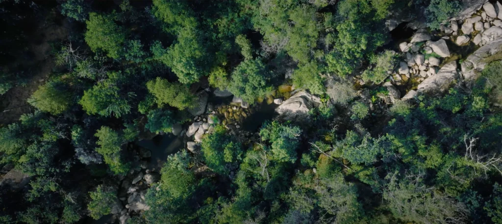
Furtado’s three areas include steep woodland, agricultural land and olive groves. Bioestrela’s Project Idea Note records protected habitats including Mediterranean heath, strawberry tree woodland, oak forest, willows and mountain streams.
Records from the wider area include bats, otters, reptiles, butterflies and rare plants. They guide surveys; they do not establish that every species occurs in every EarthCell.
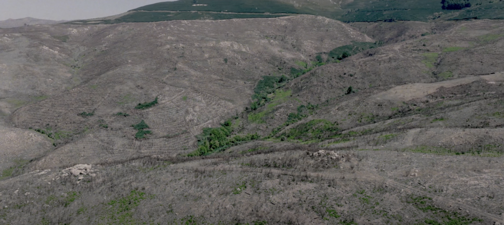
Burnt slopes above a watercourse in the Bioestrela project area. C Level project photograph.
The work
Recovery after fire
The work aims to protect what survived and help damaged areas recover. It may include reducing dangerous fuel, removing invasive species, protecting self-seeded young trees and rebuilding native trees, shrubs and ground cover.
Portugal’s AIGP programme covers basic fire safety. Bioestrela adds work on soil, water, habitat, local jobs and wildlife monitoring. On steep land, bare soil can wash away and water can run off quickly. The plan therefore needs to follow the streams, terraces, olive groves and surviving habitat rather than use one planting pattern everywhere.
Why now
Why funding is needed before a result can be measured
Plan Vivo Nature, the standard Bioestrela is working towards, concerns measured gains for wildlife. Surveys, land work, local labour, planting, natural regrowth, upkeep and monitoring all need to begin first. Furtado’s budget will explain how funding is divided before contributions open.
Early funding pays for that start. It is not a proven biodiversity result.
How it works
How EarthCell works at Furtado
The land remains with its local owners. EarthCell funding supports recovery, and the 57 mapped cells give supporters places to follow it. Fire safety, water and monitoring work across the hub, so funding is not confined to the particular cell a supporter watches.
Selecting a cell gives no land rights or management authority.
The record
The record now and next
The record begins with the 2026 boundary and the satellite measures above. Dated monitoring images, field photographs, restoration and upkeep records, wildlife findings and project reports will be added when collected, with their sources and status.
The first full wildlife survey is planned for spring 2027. Okala designed the sampling plan. Across Bioestrela, 30 cameras and 15 sound recorders will be used in two rounds of roughly six weeks each.
Furtado has 15 survey points. Each has a camera, a 20-metre square for identifying and measuring every tree, and two one-metre squares for smaller plants. Seven also have a sound recorder for bird identification. Okala will combine observations of trees, plants, mammals and birds into a biodiversity score to compare over time.
The cameras store footage on the device, so images will arrive after the survey. Exact point locations stay off the map. Plan Vivo Nature identifies them shortly before each survey to avoid concentrating care only on measured spots.
Satellite pictures may show vegetation changing. Fieldwork is needed to establish which species return and to understand why.
Explore
Explore Furtado
The map shows all three parcels and 57 EarthCells. The contour view makes the steep terrain easier to read. Selecting a plot does not reserve it or start a payment. If the map does not load, you can still contact us about the hub.
The Furtado EarthCell map loads here. If you cannot see it, you can still contact us to discuss the hub.
Certification
Progress towards Plan Vivo Nature
Furtado is part of Bioestrela’s Plan Vivo Nature pipeline. The Project Idea Note has been approved, and the full design is being written. Certification is not guaranteed. An EarthCell contribution is not a certificate, offset or biodiversity net gain unit.
Who is doing this
The Bioestrela partners
C Level, URZE and ReflorestarPT coordinate the project with landowners and communities, within the Serra da Estrela Natural Park’s conservation requirements.
URZE
URZE brings local forestry and community knowledge.
ReflorestarPT
ReflorestarPT brings restoration and agroforestry expertise.
C Level
C Level develops the project and seeks funding. Zurich Insurance funded the initial design phase for the regeneration hubs.
Talk to us
Discuss supporting Furtado
Furtado is one of EarthCell’s first sites. Contributions will be agreed individually once its budget is approved. An organisation may be able to support a part of the landscape or the whole hub.
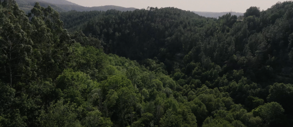
Background photograph: woodland in the Bioestrela project area. C Level project photograph.